
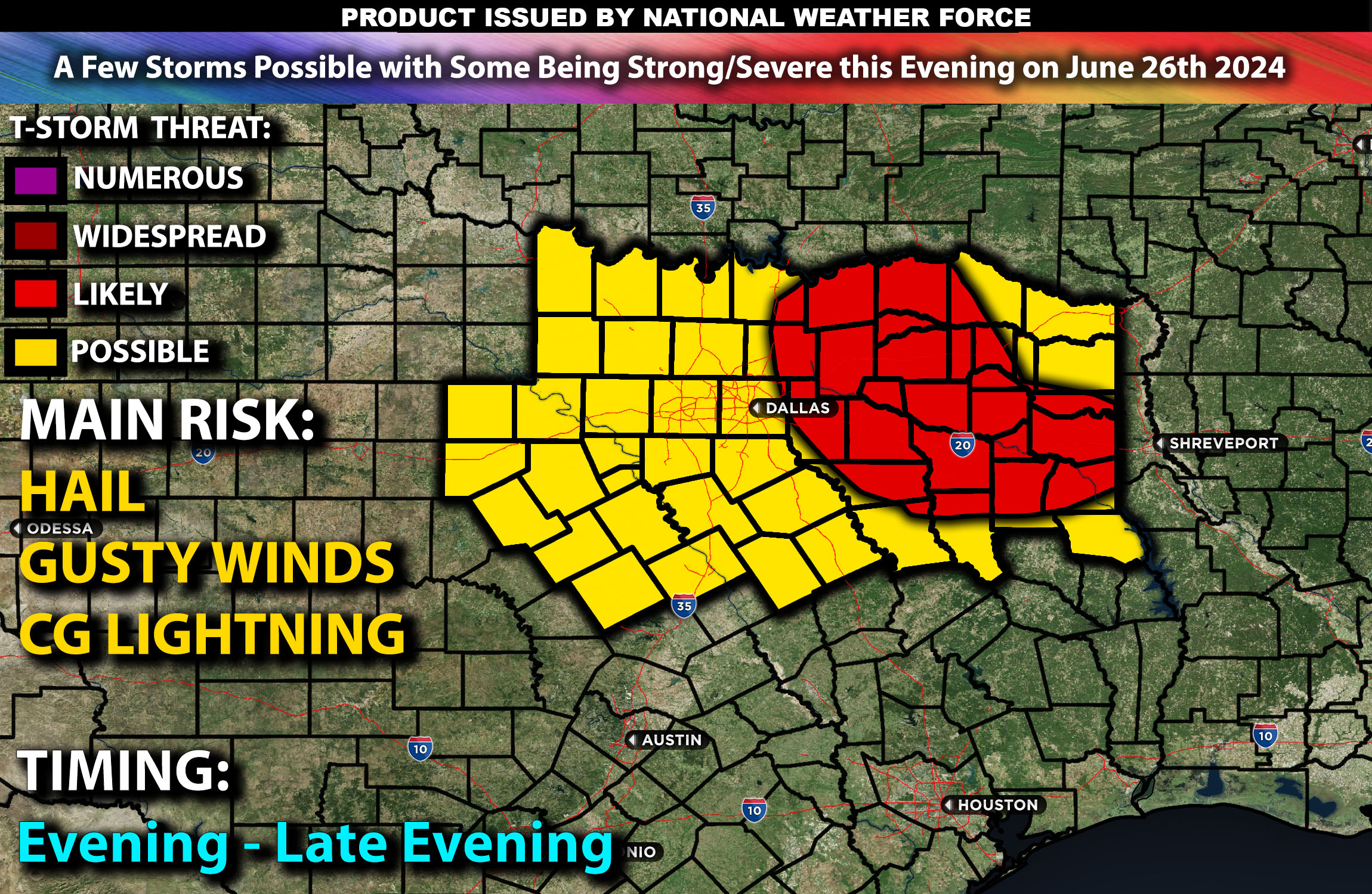
Across Northern Texas:
With the weather being unstable across the area, a few storms are likely to pop up this evening, with some potentially being strong or severe. These storms may produce hail, gusty winds, and cloud-to-ground (CG) lightning. For detailed information on timing, impacts, and more, refer below.
Detailed Forecast:
With an MCS already having moved through northeastern portions of North Texas, more severe storms will be possible given the very moist air mass in the area, with dewpoints in the low to mid-70s. Afternoon instability values are likely to reach 2200-2500 J/kg, allowing for additional thunderstorms to form. A few of these storms could potentially be strong and possibly reach low severe levels if the conditions align. These storms will form in a scattered, “popcorn” manner, potentially anywhere in the Dallas and northern Texas region later this evening before dusk.
Counties Impacted: anderson, bosque, bowie, camp, cass, cherokee, clay, collin, comanche, cooke, coryell, dallas, delta, denton, eastland, ellis, erath, fannin, franklin, freestone ,grayson, gregg, hamilton, hill, hood, hopkins, hunt, jack, palo pinto, panola, parker, rains, red river, rockwall, rusk, shelby, smith, somervell, stephens, tarrant, titus county, van zandt, wise, and wood.
Main Impacts: hail, gusty winds, and CG (cloud to ground) lightning.
Stay tuned for more updates