
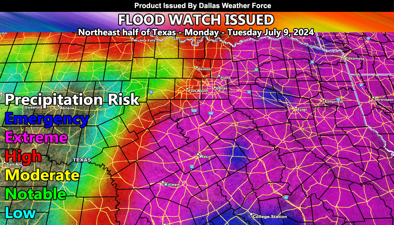
Dallas Weather Force has issued a Flood Watch for Monday into Tuesday, July 9th, 2024 out ahead of the passage of Hurricane Beryl.
Discussion: Hurricane Beryl is moving through the southwestern Gulf of Mexico as we speak. This system will strengthen just before hitting near Corpus Christi, Texas on Monday, curving north into Northeast Texas by later Monday. As the system does pass through on Monday and Tuesday early morning midnight, expecting copious amounts of rainfall to accompany the system for the Dallas Weather Force forecast zone.
Dallas Weather Force models are showing an extreme and high risk for the main metroplex zones, and east of there through the eastern sections of the forecast area.
A Flood Watch is issued here at Dallas Weather Force when conditions are favorable for higher risk flooding from the passage of a weather system and should be treated as serious as anything else issued.
– Raiden Storm –
https://www.dallasweatherforce.com
Master General Meteorologist – is the Owner and CEO of AZWF, a consulting meteorologist with over 26 years’ experience for over 50 companies, including energy, agriculture, aviation, marine, leisure, and many more areas. He has certs from Mississippi State for broadcast met and Penn State forecasting certs MET 101, 241, 341 and 361 as a meteorologist, but before then was completely self-taught, barely learning a thing from the schools that he did not already know.
NOTE: Alerts are posted on here, be it a tornado watch, etc, and these alerts are issued from this office and nowhere else. At times, which is often, you will see an alert forecast posted on here that you do not see elsewhere.